Showing posts with label trail running near Denver. Show all posts

Sunday, August 21, 2016

Running Colorado: Lair 'o the Bear Park

Technically we visited Lair o’ the Bear for a hike, but it would work well for a trail run as well, even though the Bear Creek Trail is less than 2 miles long.

We’ve passed by the trailhead countless times, so I was particularly happy to check this one off earlier this summer. The trail is just west of Idledale; about a 40 minute drive from our house in Denver and part of the Jefferson County Open Space system.

The trailhead is off I-74 (Bear Creek Road) on the left when coming from Denver and down below the highway. There’s a sizable parking lot but it fills up fast with porta-potties and several areas for picnicking. It seems like a great little spot for a picnic along the Bear Creek - either to make a day out of it or bring a picnic for after your run or hike. Fishing is allowed here (with a license and a 2 fish maximum), so we saw a number of fly fishers enjoying the day and the fast-flowing water. 

Lair o' the Bear Park - Early Morning Run blog

The first mile and a half out of the parking lot is flat and wide, following along Bear Creek; perfect for families and an easy start to a longer excursion. I’d like to bring visitors back here for a short walk as it gets you into the mountains and would be comfortable for those who aren’t used to elevation. It's possible to hear traffic noise from the highway above but the rushing water of Bear Creek covers it well for the most part, and near the end of this section is Dunafon Castle - an elaborate residence/wedding venue - on the other side of the creek. While a bit out of place, it is pretty to look at. 

Where this section of the trail comes to and end, another trail veers left and starts to climb. It’s good to know that this area has a ton of interconnecting parks via the trails. You can venture into Corwina, O’Fallon, and Mt Falcon parks with seemingly endless trails to explore. The path we took seamlessly connected into Corwina Park and while the trail is substantially shaded, there are sections without cover and with a lot of sun, where the temperature can rise quickly. While this trail isn’t far into the foothills, it does start around 6,500 feet and rises from there, so the thin air is nothing to take lightly. Hydration and sunblock are a must.

Lair o' the Bear and Corwina Park - Early Morning Run blog

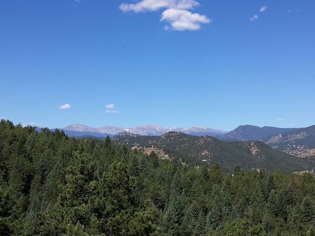
On numerous occasions we had to jump to the side of the trail as mountain bikers passed by. While technically bikers are to yield to hikers and runners, it’s much easier for us to wait for them, than for them to stop, especially on steep or rocky terrain or narrow passes, as is the case for much of this trail. This would have been a bit annoying if we had been running - it seems to be a popular trail with mountain bikers, likely due to the proximity to Denver - but as we were hiking it was fine.
Lair o' the Bear Park - Early Morning Run blog


We went about 7 miles out and back, which provided a solid workout with some serious climbs and beautiful views of the mountains. We were glad to have some snacks with us and a good amount of water, as we took a bit of a break half way through to enjoy the view and refuel for the trip back to the car. The flat section along the creek on the way back was welcomed and all I wanted to do was put my feet in the cold rushing water! 

Sitting by Bear Creek at the end of the hike - Early Morning Run blog


What to know if you go:
  • Go early for a parking spot or else you might end up along the entrance road
  • Take plenty of water, a snack (if you’ll be out for a while), sun block, and a hat
  • Snap a photo of the big trail map at the trailhead to have on your phone - but know that this only covers the small Lair o’ the Bear Park and not the surrounding trails (you’ll want to take screenshots of those maps on your phone before you head out)
  • Porta-potties are available at the trailhead but no water
  • Be ready to get out of the way of mountain bikers
  • There are nice picnic tables & grills for a post-run picnic
  • If you’re not up for a picnic, Lariat Lodge Brewing in Evergreen is a great spot for post-run brunch and beer
What's your favorite running or hiking trail near Denver? * Do you ever run trails alone?

Sunday, May 8, 2016

Trail Running: Dakota Ridge & Red Rocks Trails

Last weekend we took a road trip down to Santa Fe for a luxuriously relaxing few days that included trail running, a few bruises, window shopping, incredible food, and our fair share of margaritas. But more on that later. I need to jump back a few weeks to get a recent trail run on the interwebs.

Beginning with the Colfax Marathon Relay next weekend, I have three races coming up in a matter of five weeks. BolderBOULDER, which may be considered a new tradition for us in our 3rd year straight, will come next and culminating with the Garden of the Gods 10 Miler. As I haven't run 10 miles since my last half marathon in 2011 - when I fractured my femur and came to the hard truth that I had to drastically cut back on my mileage.

In an attempt to be ready for these races, particularly the hilly 10 miler at higher elevation, I'm incorporating some technical trail running into my training, although I'm not following any specific plan.

Dakota Ridge Trail


A few weeks ago we took on Dakota Ridge Trail and Red Rocks Trail which is about a 20 minute drive from Denver and right near Red Rocks Amphitheater. We parked in the dinosaur lot across the road from the main Matthews Winter Park lot (pictured in the bottom right of the photo above). Right out of the gate we were climbing and it didn't take long for my heart to start pounding.

Dakota Ridge Trail

Dakota Ridge Trail

While we've hiked more difficult trails, this was the most technical we've run - at least the Dakota Ridge section. The terrain changed quite a bit throughout the 6 miles but there were plenty of steep rocky climbs and descents; long slow climbs; creeks to pass; rolling hills, and a lot of beautiful views.

Climbing Red Rocks Trail

We went early and on a morning that was overcast, as you can see from the photos. I believe this is key because while a clear blue sky would make for stunning views, the vast majority of the trail is exposed with little, to no, shade so I'm sure it can get very toasty.

Two days after this run my shins and ankles were still a bit sore. Definitely important to stretch and roll after this run. And eat well to help your muscles recover. My ankles aren't used to working so hard! Clearly I need to spend more time on the trails but I can already tell that the time we have spent recently has helped my running.

Red Rocks Trail

If you go:
  • Go early to avoid the heat and crowds
  • Carry a little water
  • Wear sunblock and consider a cap
  • Park in the small lot across from the Matthews Winter Park lot (less crowded, I'd say)
  • If you haven't been to Red Rocks, take a drive up to the amphitheater when you've finished, it's usually open in the morning and a national treasure (IMHO)
  • Find our 6 mile loop on MapMyRun
Do you incorporate trails into your running? * What races do you have coming up?


Sunday, April 24, 2016

Running Waterton Canyon (+ an Epic Wipes Giveaway)

It's been a solid month since I last wrote. Not because I haven't been doing anything, but rather I've been so busy I just haven't had the time to sit and write. It's going to take me a bit of time to catch up, but let's start with a run.

Several of my Oiselle teammates have been clocking a number of long runs prepping for Boston and other spring marathons, and I had noticed a number of conversations - and beautiful Insta shots - around Waterton Canyon. So a few weeks ago on a nice morning, Matt and I headed south about 30 minutes from our house in Denver to the canyon, just a bit past Chatfield State Park. 

Waterton Canyon, also known as Platte Canyon, runs along the Platte River which supplies a great amount the water from the mountains to the Denver-metro area. There's a rather large parking lot with an outhouse just past the entrance to the Lockheed Martin facility. After crossing the road you'll encounter the trail sign and a pretty nice - and what looks to be new - water fountain perfect for bottle filling.

(Note that Waterton Canyon is closed Monday - Saturday until May 15 while work is being done on one of the dams. Enjoy the canyon on Sunday's until then.)

Waterton Canyon Trailhead


The path for runners and hikers is a wide dirt road that is pretty unassuming at the start. It's not until a few minutes into the run that you connect to the river and finally begin to see what all the fuss is about. While the road winds through the canyon along the river, and the mountain provides some shade, there are long stretches when the sun beats down. The temperature swing was pretty drastic between shade and sun - an aspect of Colorado weather you get used to pretty quickly.

As many of my friends love to run and hike with their dogs, I'll mention now that mountain goats are common in this area so to protect the natural wildlife, dogs are not allowed in Waterton Canyon. Mountain biking, foot traffic, and limited fishing in designated areas, are allowed.

Waterton Canyon


As usual, we started out on the early side as we'd rather not be on trails during the heat of the day. It was cool when we started and quite toasty when we finished. We ran a bit over 4 miles up the canyon to Mill Gulch Bridge where the trail/road switches to the other side of the river. The trail starts at about 5550 feet elevation and climbs steadily into the mountains. I could definitely feel it in my legs and breathing, but the nice thing about running up a canyon is that once you turn around and head back, you're going down the whole way.

Waterton Canyon


It really was beautiful scenery and a different type of run than we're used to. The dirt road means that it's not technical but you get to enjoy a softer surface than running on a regular street, plus if you're doing a long run there's no thinking involved. Just head out and go. Well, keep an eye out for wildlife and mountain bikers, but you don't have to worry about traffic or keeping track of your route. Plus, this is the entrance to the Colorado Trail, which stretches 500 miles to Durango. 

By the time we got back to the car, we were pretty toasty and a good bit dusty. Since we wanted to stop for coffee and brunch on our way home, we needed to clean up a bit. Thankfully, a few years back a cool new company, Epic Wipes, had reached out to me to try their product and I was psyched to try it out.

Epic Wipes


At more than 2 feet long, Epic Wipes are the most massive and amazing wet wipes you will ever lay your hands on. They are like nothing you've tried. Created by a doctor who's been stationed in Afghanistan and has worked with patients at Walter Reed Medical Center, Aeneas Janze decided to create a product that could actually be useful to anyone without access to a shower and doesn't require 10+ small wipes to get clean (we've all been there at some point, right?). 

These genius wipes are made of bamboo and other biodegradable materials, they are free of parabens and utilize antibacterial oils including chamomile and eucalyptus. They feel cool on the skin even after hours sitting in a car trunk on a hot day.

After our run up the canyon, Matt and I cleaned up with these wipes and they were perfect. I can't begin to explain how awesome they felt after that hot, dusty run. This product really could be useful for so many people beyond runners, the uses seem pretty limitless.

Epic Wipes

Epic Wipes


Unfortunately for us, these aren't on the market quite yet. While packaging is done and there's a great product video, from what I understand, the company is getting ready to launch a Kick Starter campaign, which you can get updates about by signing up on the website.

GIVEAWAY

But, lucky for you, I have some to give away! I really just want to keep them all for myself, but two lucky people will win two Epic Wipes. 

I'm going to make it crazy easy for you to enter with a few options:
  1. Click HERE to Tweet about this giveaway (it'll open in another window) and leave a comment.
  2. Follow Epic Wipes on Facebook - and leave a comment below when you have
  3. Leave a comment on when you'd use Epic Wipes.
  4. Follow me on Instagram HERE and leave a comment to let me know.
To win, you must live in the continental United States. You MUST leave a comment on this post for your entry to count. Two winners will be chosen randomly. Entries will be accepted until 5:00pm MT, Wednesday, May 26th. The wipes I tried, and the wipes for this giveaway have all been provided by Epic Wipes. The thoughts I've expressed about Epic Wipes are all my own. 

Good luck!

Sunday, March 29, 2015

Trail Running: North Table Mountain Park (Golden, Colorado)

With a beautiful morning on tap and an itch to try a new trail, Woody and I headed to North Table Mountain Park in Golden Saturday morning. This is a great park for running, hiking, and mountain biking within a 20 minute drive of Denver.

Already around 55 degrees when we arrived at 8:30am, we left extra layers in the car and applied sunblock as there is no shade on North Table Mountain. The rock formation that juts out of the ground to towering heights just east of the foothills, is a result of ancient lava flows in the area. The park boasts more than 15 miles of trails through rocky terrain and many steep climbs. 

I drive by this park often between Denver and Boulder, and I have to say it's pretty intimidating, but based on the large number of people I've seen tackling the mountain from the trailhead off route 93, I knew we'd be able to do it. Heather's (of Just a Colorado Gal) account of her run at North Table Mountain inspired our run.

Our Route: We started at Easley Road Trailhead taking the short Lithic Trail to turn north on North Table Loop, around the north side to Mesa Top Trail, a quick detour on Tilting Mesa Top Trail then back to Mesa Top, to Cottonwood Canyon Trail which connects back in with North Table Loop and Lithic back to the trailhead.

Parking at the Tony Grampsas Memorial Sports Complex off W 44th Avenue, we found it a bit difficult as first timers to find the trailhead across Easley Road. (Hint: take the dirt path out of the parking lot then when you get to the JeffCo Open Space Trail turn right and take the path a few hundred yards till you reach a wood bridge over the ditch leading to a few parking spots on Easley. Across the road is the trailhead.)

Right from the start you're heading up. And up. Only a few minutes into the run and I was breathing heavy and wondering what we had gotten ourselves into. Even with snow and rain a few days earlier, the rocky trail was pretty dusty. There were a number of long sections with packed dirt trail, that were almost as difficult to navigate as the rocky sections.

North Table Mountain Park

After some serious climbing, this route provides some downhill sections that lull you into a feeling that it's going to be an easy, relaxing run. But just to your left there's a huge, imposing wall of rock, so it's hard to ignore the fact that at some point you're going to go up again.

Just then, there was one long section that really pushed my limits and I had to slow to a hike. It was long and steep and just around a curve it kept going up. A few guys passed me and I told Woody to go ahead and I'd meet him at the top. He didn't think it was easy either, but he was able to run more of it than I was. 

North Table Mountain Loop

Running North Table Mountain Park

Finally we hit the flat top of the mountain and I was able to catch my breath. The trail winds around a pond and around the top of the mountain for a bit before you reach a few lone trees and then some serious switch backs start down the mountain. 


This is a popular trail system for mountain bikers - how they get up or down some of these trails is beyond comprehension for me - so we had to pull off quite a few times to let them pass. While runners technically have the right of way, it's much easier for us to let them pass than them to stop. There are some really tight spots on the trail that runs right between a steep decent and a steep incline, so you have to be careful and watch your step closely. The loose rocks could be dangerous. 

That's the one thing that bothers me about trail running. I spend so much time looking at the trail I hardly get to enjoy the views! We rounded finished our run at 7 miles and I was actually feeling really good and accomplished at the end. There is a lot more ground to cover at this park, and there it's quite a unique spot, but I think we'll explore a few others before we head back here - unless we're looking for some serious punishment on the hills!

Running Cottonwood Canyon Trail


If you go:

  • Go first thing in the morning. With no shade, it could brutally hot in the middle of the day
  • Sunscreen is a must
  • Take water (and some food if you plan on being out there for a long time)
  • Share the trail. It's a heavily used trail system so be sure to watch out for others, especially on tight sections.
  • Watch out for, and respect, the wildlife. The area is home to mule deer (we saw a few), rattlesnakes (thankfully we didn't see any), prairie dogs, and birds including golden eagles and red-tailed hawks
  • Take a map of the park - which you can find here. Tip: Take a photo of the map at the trailhead with your phone so you don't have to carry paper that'll likely get wet with sweat!
  • When you've finished your hike, drive a few minutes into downtown Golden to grab some iced coffee and eats at the Windy Saddle Cafe. (Good selection of gluten free items but they could stand to add a few for vegans) 
What type of gear do you use for hydration on a long run when there aren't any drinking fountains on your route? * Which do you prefer - the trail or the road?