Showing posts with label hikes near Denver. Show all posts

Tuesday, November 1, 2016

Colorado Hike: Back to Staunton State Park

If I haven't mentioned it often enough, Colorado is a pretty spectacular place to live if you like to play outdoors. To take advantage of the warm, early-fall like weather, Matt and I headed back to a park we visited our first fall in Colorado, not long after it opened - Staunton State Park.

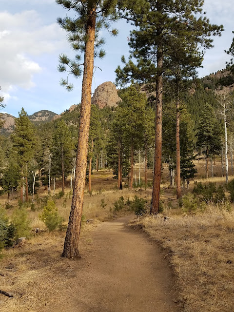
Early Morning Run - Staunton State Park trail

Early Morning Run - Staunton State Park view


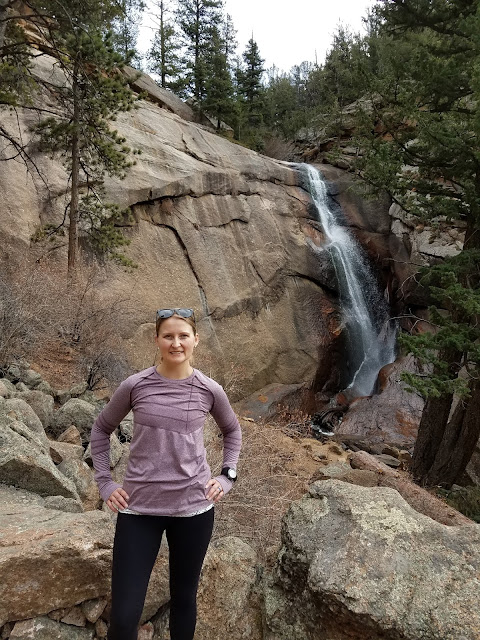
With nearly 4,000 acres and seemingly endless miles of trails, we could go back many more times to explore different areas of the park. The first time we went we hiked to the falls overlook and the trail to Elk Falls wasn't quite finished. This time, we wanted to get up close and person with the waterfall. And we did. The waterfall is quite beautiful but I'm sure at some points in the year it's just roaring!

This was our half-way point, so we took a break and enjoyed a snack and the view before starting back to the trailhead. We saw a good number of people along the trail, but we had this spot to ourselves.

Early Morning Run - Lisa standing in front of the Elk Falls

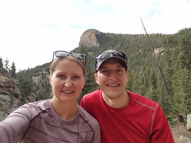
Early Morning Run - Staunton State Park selfie


Finishing out at 12 miles, the hike was a bit more strenuous and longer than we anticipated when we set out, but we were enjoyed every minute of it. The varied topography kept things interesting. The trailhead starts in a grassy meadow, you pass by and climb granite cliffs, hike along a stream and of course, sit next to a beautiful waterfall in a canyon.

It was a really nice day that we finished with a picnic lunch in the pavilion at the trailhead before heading back to Denver and collapsing on the couch.

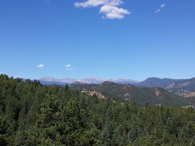
Early Morning Run - Staunton State Park landscape

What to know if you go:

  • The park is only about 45 minutes from Denver.
  • There's a $7.00 daily fee if you don't have an annual pass.
  • The trailhead facilities are great and well taken care of, including port-a-potties, a great pavilion (available for rent) and plenty of picnic tables and grills.
  • While most of the trails are multi-use - available for runners, hikers, mountain bikers and equestrians - there are several trails that are for hikers/runners only. 
  • Here's the map you'll want; the gate keeper can also provide one when you arrive.
  • Spring 2017, the park will begin offering the use of specialized all-terrain motorized trail that will allow disabled visitors the ability to enjoy the park. It's pretty incredible, read about it here.
If the weather's still warm where you live, how are you taking advantage of it? * What are your favorite snacks to take with you on a hike?

Sunday, August 21, 2016

Running Colorado: Lair 'o the Bear Park

Technically we visited Lair o’ the Bear for a hike, but it would work well for a trail run as well, even though the Bear Creek Trail is less than 2 miles long.

We’ve passed by the trailhead countless times, so I was particularly happy to check this one off earlier this summer. The trail is just west of Idledale; about a 40 minute drive from our house in Denver and part of the Jefferson County Open Space system.

The trailhead is off I-74 (Bear Creek Road) on the left when coming from Denver and down below the highway. There’s a sizable parking lot but it fills up fast with porta-potties and several areas for picnicking. It seems like a great little spot for a picnic along the Bear Creek - either to make a day out of it or bring a picnic for after your run or hike. Fishing is allowed here (with a license and a 2 fish maximum), so we saw a number of fly fishers enjoying the day and the fast-flowing water. 

Lair o' the Bear Park - Early Morning Run blog

The first mile and a half out of the parking lot is flat and wide, following along Bear Creek; perfect for families and an easy start to a longer excursion. I’d like to bring visitors back here for a short walk as it gets you into the mountains and would be comfortable for those who aren’t used to elevation. It's possible to hear traffic noise from the highway above but the rushing water of Bear Creek covers it well for the most part, and near the end of this section is Dunafon Castle - an elaborate residence/wedding venue - on the other side of the creek. While a bit out of place, it is pretty to look at. 

Where this section of the trail comes to and end, another trail veers left and starts to climb. It’s good to know that this area has a ton of interconnecting parks via the trails. You can venture into Corwina, O’Fallon, and Mt Falcon parks with seemingly endless trails to explore. The path we took seamlessly connected into Corwina Park and while the trail is substantially shaded, there are sections without cover and with a lot of sun, where the temperature can rise quickly. While this trail isn’t far into the foothills, it does start around 6,500 feet and rises from there, so the thin air is nothing to take lightly. Hydration and sunblock are a must.

Lair o' the Bear and Corwina Park - Early Morning Run blog

On numerous occasions we had to jump to the side of the trail as mountain bikers passed by. While technically bikers are to yield to hikers and runners, it’s much easier for us to wait for them, than for them to stop, especially on steep or rocky terrain or narrow passes, as is the case for much of this trail. This would have been a bit annoying if we had been running - it seems to be a popular trail with mountain bikers, likely due to the proximity to Denver - but as we were hiking it was fine.

Lair o' the Bear Park - Early Morning Run blog


We went about 7 miles out and back, which provided a solid workout with some serious climbs and beautiful views of the mountains. We were glad to have some snacks with us and a good amount of water, as we took a bit of a break half way through to enjoy the view and refuel for the trip back to the car. The flat section along the creek on the way back was welcomed and all I wanted to do was put my feet in the cold rushing water! 

Sitting by Bear Creek at the end of the hike - Early Morning Run blog


What to know if you go:
  • Go early for a parking spot or else you might end up along the entrance road
  • Take plenty of water, a snack (if you’ll be out for a while), sun block, and a hat
  • Snap a photo of the big trail map at the trailhead to have on your phone - but know that this only covers the small Lair o’ the Bear Park and not the surrounding trails (you’ll want to take screenshots of those maps on your phone before you head out)
  • Porta-potties are available at the trailhead but no water
  • Be ready to get out of the way of mountain bikers
  • There are nice picnic tables & grills for a post-run picnic
  • If you’re not up for a picnic, Lariat Lodge Brewing in Evergreen is a great spot for post-run brunch and beer
What's your favorite running or hiking trail near Denver? * Do you ever run trails alone?

Sunday, March 29, 2015

Trail Running: North Table Mountain Park (Golden, Colorado)

With a beautiful morning on tap and an itch to try a new trail, Woody and I headed to North Table Mountain Park in Golden Saturday morning. This is a great park for running, hiking, and mountain biking within a 20 minute drive of Denver.

Already around 55 degrees when we arrived at 8:30am, we left extra layers in the car and applied sunblock as there is no shade on North Table Mountain. The rock formation that juts out of the ground to towering heights just east of the foothills, is a result of ancient lava flows in the area. The park boasts more than 15 miles of trails through rocky terrain and many steep climbs. 

I drive by this park often between Denver and Boulder, and I have to say it's pretty intimidating, but based on the large number of people I've seen tackling the mountain from the trailhead off route 93, I knew we'd be able to do it. Heather's (of Just a Colorado Gal) account of her run at North Table Mountain inspired our run.

Our Route: We started at Easley Road Trailhead taking the short Lithic Trail to turn north on North Table Loop, around the north side to Mesa Top Trail, a quick detour on Tilting Mesa Top Trail then back to Mesa Top, to Cottonwood Canyon Trail which connects back in with North Table Loop and Lithic back to the trailhead.

Parking at the Tony Grampsas Memorial Sports Complex off W 44th Avenue, we found it a bit difficult as first timers to find the trailhead across Easley Road. (Hint: take the dirt path out of the parking lot then when you get to the JeffCo Open Space Trail turn right and take the path a few hundred yards till you reach a wood bridge over the ditch leading to a few parking spots on Easley. Across the road is the trailhead.)

Right from the start you're heading up. And up. Only a few minutes into the run and I was breathing heavy and wondering what we had gotten ourselves into. Even with snow and rain a few days earlier, the rocky trail was pretty dusty. There were a number of long sections with packed dirt trail, that were almost as difficult to navigate as the rocky sections.

North Table Mountain Park

After some serious climbing, this route provides some downhill sections that lull you into a feeling that it's going to be an easy, relaxing run. But just to your left there's a huge, imposing wall of rock, so it's hard to ignore the fact that at some point you're going to go up again.

Just then, there was one long section that really pushed my limits and I had to slow to a hike. It was long and steep and just around a curve it kept going up. A few guys passed me and I told Woody to go ahead and I'd meet him at the top. He didn't think it was easy either, but he was able to run more of it than I was. 

North Table Mountain Loop

Running North Table Mountain Park

Finally we hit the flat top of the mountain and I was able to catch my breath. The trail winds around a pond and around the top of the mountain for a bit before you reach a few lone trees and then some serious switch backs start down the mountain. 


This is a popular trail system for mountain bikers - how they get up or down some of these trails is beyond comprehension for me - so we had to pull off quite a few times to let them pass. While runners technically have the right of way, it's much easier for us to let them pass than them to stop. There are some really tight spots on the trail that runs right between a steep decent and a steep incline, so you have to be careful and watch your step closely. The loose rocks could be dangerous. 

That's the one thing that bothers me about trail running. I spend so much time looking at the trail I hardly get to enjoy the views! We rounded finished our run at 7 miles and I was actually feeling really good and accomplished at the end. There is a lot more ground to cover at this park, and there it's quite a unique spot, but I think we'll explore a few others before we head back here - unless we're looking for some serious punishment on the hills!

Running Cottonwood Canyon Trail


If you go:

  • Go first thing in the morning. With no shade, it could brutally hot in the middle of the day
  • Sunscreen is a must
  • Take water (and some food if you plan on being out there for a long time)
  • Share the trail. It's a heavily used trail system so be sure to watch out for others, especially on tight sections.
  • Watch out for, and respect, the wildlife. The area is home to mule deer (we saw a few), rattlesnakes (thankfully we didn't see any), prairie dogs, and birds including golden eagles and red-tailed hawks
  • Take a map of the park - which you can find here. Tip: Take a photo of the map at the trailhead with your phone so you don't have to carry paper that'll likely get wet with sweat!
  • When you've finished your hike, drive a few minutes into downtown Golden to grab some iced coffee and eats at the Windy Saddle Cafe. (Good selection of gluten free items but they could stand to add a few for vegans) 
What type of gear do you use for hydration on a long run when there aren't any drinking fountains on your route? * Which do you prefer - the trail or the road?

Monday, October 6, 2014

Golden Aspens from 9,300 Feet

As far as I’m concerned, fall is a pretty wonderful season for a few reasons: 1) college football season (Go State!); 2) runs are much more enjoyable when they’re not so sweaty; 3) pumpkin everything + fantastic hauls at the farmers market, 4) the spectacular colors. Thankfully, living in Colorado we get to enjoy all of this!

Golden Gate Canyon

One of the best ways to enjoy fall in Colorado is to go for a hike. We recently explored Golden Gate Canyon State Park – 16 miles west of Golden, Colorado, the 12,000 acre park boasts 11 trails covering nearly 35 miles. Less than an hours drive from our house, I was caught off guard when I got out of the car at the visitors center to pay $7.00 for our day pass, and it was probably 20 degrees colder than when we left our house. I should have been prepared for this, being as the park ranges in elevation 7,600 feet to 10,400 feet. I still find it amazing how close we live to the mountains!

Golden Gate Canyon Bear Trail

At the advice of a very helpful park ranger, we chose to start on the Black Bear trail (rated “most difficult”) and then loop back to the trailhead on the Horseshoe trail (“moderate”) for a total just over 5 miles. If we had more time, we would have gone a bit father as it was an absolutely beautiful park – I’d dare to say my favorite so far. Again, I’m thankful we got up there early as we were the first car in the parking lot that was overflowing when we returned, and we only saw 3 other people and one dog on the Black Bear trail but a ton of people as we were getting towards the end of our hike.

Golden Gate Canyon 3

One reason why I loved this park was the variety of terrain – rocky climbs, packed gravel, sandy paths, pines and aspen groves. It was not a boring park at all, and we only saw a very small part of it! With so much to explore, the park has two campgrounds and several cabins, yurts, and a guest house, as well as back country camping.

Golden Gate Canyon Matt 2

Woody obviously was loving the hike too. Turned out once we got out of the valley and started hiking in the sun, the temperatures warmed up pretty fast! And that’s a good thing too, because all I was not dressed for the cold! Starting at about 8,200 feet with an elevation gain of 1,120, the Black Bear trail definitely gets the heart pumping!

Golden Gate Canyon Lisa

There are many mixed use trails through the park, but the ones we took were hiking only, which was perfect. It was nice not having to jump to the side as mountain bikers whizzed by.

Golden Gate Canyon Trail

You may not believe me from these pictures, but this park does get pretty packed. The proximity to Denver and other towns, number and range of trails, camping options and beauty, makes it a perfect destination for all types of people and groups. While it was great when we had the trail to ourselves, it was also pretty awesome to see all the parents on the trail with their young kids. I love that they start them hiking so early!

Golden Gate Canyon Aspen Trees

We took this hike on Saturday, September 27, I’m sure the colors are even brighter now, but like everything good, they don’t last long so it’s important not to wait too long in the fall to get out there.

Where is your favorite place to hike?

Monday, September 22, 2014

Hiking O’Fallon Park (Kittredge, Colorado)

We have done very little hiking this summer. While we had planned to do quite a bit during August, those plans were put aside as Woody and I both ended up traveling more than we had expected. So on the last weekend of summer, we made a point to get out for a hike!

O'Fallon Park Trailhead

We stuck close to Denver and headed up to O’Fallon Park not far from Evergreen, but just outside Kittredge – about a 40 minute drive from our house in Sunday morning traffic. The road we took to the park was pretty narrow and windy, but beautiful. O’Fallon is in an area where there are parks all over – with many options for hikers, trail running, mountain bikers and even some that allow horseback riding.

O'Fallon Park Overview

Many of the parks are interconnected; this one in particular connects in with Corwina, Lair O’ The Bear, and Pence parks, resulting in many options when it comes to exploring! With this being our first visit to O’Fallon Park, we headed out on Meadow View Loop, expecting to take it around back to the trailhead after exploring a few short out and backs for a total of about 4 miles.

Matt_O'Fallon Park

We are definitely still learning when it comes to hiking, as we were reminded once again when we took a left turn instead of going straight along a grassy piece of the trail. We ended up going the opposite direction from what we intended! Thankfully, we had a map – we do know that a strong cell signal out on the trails is rare – so we were able to figure out where we had ended up. Instead of a loop, we did an out and back of 4.5 miles.

O'Fallon Park Hike

We did find a nice little high spot near panorama point perfect for a quick break to enjoy the view, fresh air and chirping birds. There was a threat of rain but thankfully we had peeks of sun and blue sky! The weather can be completely different in the city and the mountains, even the foothills, and it can change suddenly so we took rain jackets in our backpack with the water and had extra socks and shoes waiting in the car. Thankfully we didn’t need them!

O'Fallon Park

There were a good number of other people out on the trails – I’d say more mountain bikers than hikers – but it wasn’t crowded. I enjoyed the shade, varying terrain and proximity to the city. Even though there are many places to hike around here, I wouldn’t be opposed to going back and staying on the trail we had planned to hike! I’d say this is a good place for locals and those visiting Denver who are looking for a good workout. Another nice aspect is that there are several nearby small towns including Evergreen, Kittredge and Morrison with cute cafes perfect for a post-hike brunch!

What did you accomplish on the last weekend of summer? * What are you most looking forward to this fall?