With our first mountain race coming up this month, Matt and I are in need of logging some miles at altitude. Recently we decided to try out the Peaks Trail which runs between Frisco and Breckenridge. Many run this trail as an out and back, for a total of about 16 miles, but since we weren’t in need of (or in shape for) that many miles, we decided to try it one way and find our way back to our car.
With a decent amount of research but little detail to be found, I did learn that it is possible to take a free bus from Breckenridge to Frisco (and vice versa) but little information on how to get to the bus. So keep reading for more on that.
The Frisco trailhead is just through town, turn left down 2nd Ave and down the road about a mile or so you’ll find a parking lot on the right. If you curve towards the left, you’ve gone too far. Keep an eye out for cyclists as you’ll cross over the paved trail that runs between the two towns to get into the parking lot. Note that there is no ports-potty at this trailhead, so you might want to make a pit stop in town.
If leaving from Frisco, as we did, you encounter Rainbow Lake a little less than a mile in, which was pretty busy when we were there as it’s a nice spot for dogs to play in the water and in itself, a nice turnaround spot for locals or families just wanting a short hike in the woods.
Not long into the run/hike (we ran at least 5 miles, but again, I wasn’t in shape for a 8 mile trail run) I knew I was going to like it. The terrain changes quite a few times and while there are some definitive climbs, it’s nothing too serious and easily tackled by a quick-paced hike. The vast majority of the trail winds through woods, which I like because it means you’re protected a bit from the hot Colorado sun.
We saw a fair amount of other people out on the trail; most hiking or mountain biking, some running, but there were times when we had the trail to ourselves which is always nice. As per usual, it’s best to get started early.
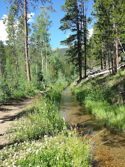
Beyond Rainbow Lake, much of the trail winds through the woods along a fast-flowing creek that adds a bit of coolness to the air and a nice soundtrack to the run, towards the later part of the trail you’ll run along a viaduct of sorts that we think must be man-made and perhaps helps reduce erosion from water run-off as the snow melts. In a few spots along the way we were reminded of some trails we hiked in the pacific northwest because of the bright green moss and ferns and overall swampiness, complete with wooden bridges to get you through.
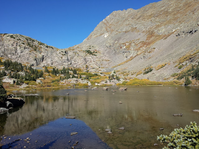
While most of the trail runs through the woods as I mentioned, there are a few spots with nice views of the mountains. Do yourself a favor and stop and take them in because you won’t get many chances to on this trail. According to the Trail Run Project, the trail starts at 9,088 feet, tops out at 10,165 and ends at just under 10,000. The first 3.5 miles are a steady climb with a few ups and downs, then a nice decent before another climb to the peak of the trail (not the peak of the mountain, your in the Breckenridge ski mountain area) and a few climbs and decants before one final, quality decent to the trailhead at the Breckenridge end, again in dense forest. A few trails split off from the Peaks Trail, but it’s fairly well marked and easy to stay on course.
Even without looking at our watches we knew we were getting close to the end because of the amount of people and families on the trail. It finishes at a dirt parking lot at the end of the paved section of Ski Hill Road and just past the Grand Lodge at Peak 7 with a restaurant and (public) restrooms and water fountains. In all the overviews I read about this trail, not one mentioned there is an actual trailhead. So know that, if you’d like to start from the Breck end, this trailhead with parking lot exists (porta-potties do not, but clean, indoor restrooms do).
It took us about two and a half hours to complete, which included a few picture breaks and a bit of hiking. We were pretty happy with this and felt like we could tackle a few more miles, but decided to head into town instead.
Turns out the gondola, which can be accessed just past the Grand Lodge and its neighboring Crystal Peak Lodge, is free. So we hopped on and took a ride down the mountain. If you haven’t been to Breck before, it’s good to know that the gondola drops you off just a block away from the main street in town, which is awfully convenient. By the time we get off, we’re sufficiently hungry and ready for breakfast.
I had done a little research the day before and found a spot called Amazing Grace which sounded perfect for two vegans after a run. I’ll warn you that this spot is off the main street and up a hill, but it’s worth it. And it’s not just for vegans and vegetarians. The cute little yellow house has several tables inside with a back patio. The fresh menu is filled with sandwiches, breakfast burritos and other breakfast plates, and the staff was super helpful and accommodating. While we’ve been to Breck a few times this was our first visit to Amazing Grace and from now on it’ll be our go-to spot.
After becoming sufficiently full, we headed back to the transportation center where the gondola lets off to pick up the Summit Stage bus back to Frisco. This was an easy process but the bus only comes every 30 minutes or so, which means we ended up waiting around for a bit. Be sure you get on the Frisco bus rather than one heading to another regional town like Keystone or Silverthorne. The bus drops off on Frisco’s main drag and it’s another mile or so walk back to the trailhead where we found our car, cleaned up and headed off to Broken Compass Brewery.
What to know, if you go:
- There are trailheads with parking lots at both ends; neither have porta-potties or water
- While this isn’t the highest trail in the area, you’re still in the mountains so take layers
- If going one-way from Frisco to Breckenridge, pick up the gondola just down Ski Hill Rd for a free ride down into town; the free Summit Stage bus can be caught at the bus loop just outside the gondola drop for a ride back to Frisco
- If you start from the Breck end, drive up Ski Hill Rd till you hit the trailhead; if you’re doing one-way to Frisco once you make it to the trailhead turn left at 2nd Ave, walk till you hit Main St then turn right and walk several blocks to the bus stop for your trip back to Breck and the gondola ride back up
- Take a picture or two of the trail map with your phone so you can reference along the way if you feel the need
- Don’t forget to wear sunblock (higher altitude, thinner air) and drink plenty of water to stay hydrated
- Visit Amazing Grace in Breckenridge for your post-run brunch.
- Have fun and enjoy the journey!
Here's a helpful link for a trail map and elevation chart: www.trailrunproject.com/trail/7002524/peaks-trail
When you go trail running, do you prefer big views or forest shade? * With so many trails, how do you choose which ones to run or hike?
When you go trail running, do you prefer big views or forest shade? * With so many trails, how do you choose which ones to run or hike?


